One of the challenges for researchers is collaborating and communicating with communities to solve social and environmental problems. However, that challenge is what inspires and motivates scientists to keep investigating important questions.
Jamie Hoover (Ph.D. ’16) and Eric Rounds (M.A. ’16), former students of Associate Professor of Geography Stephen J. Leisz, were motivated to use geographic methods and training to investigate land-use issues in Papua New Guinea and Central Vietnam, respectively.
Geographers investigate how humans and the environment spatially interact. Leisz, specifically, looks at land change science and the drivers of land-use and land-cover changes. “I investigate the human-environment interactions that lead to land-use and ultimately land-cover changes by using remote sensing data, such as current and historical satellite imagery, aerial photographs, and lidar, participatory fieldwork, and geographic information systems (GIS), in collaboration with communities who live in the study areas,” explains Leisz.
This exploration of land-use and land-cover change is based on questions about the impact of changes on the environment and community, as well as the drivers of those changes. The results and interpretation of the data provide insight into environmental, political, and economic challenges and assist with land policy and management decisions at local, national, and international levels.
Subsistence Agriculture in Papua New Guinea
The questions Hoover wanted to ask centered on subsistence agriculture in Papua New Guinea. “Papua New Guinea is a unique corner of the world that is often overlooked by most researchers, even though the country is known for its rich biodiversity,” says Hoover.
Hoover’s first visit was in 2011 with collaborators from the Bishop Museum, funded through a National Science Foundation grant that Leisz and collaborators at the Bishop Museum received to investigate Papua New Guinea’s megadiverse flora. Hoover and fellow scientists spent a month in the small coastal village of Kamiali.
Her research looked at land-use and land-cover change in Kamiali, specifically investigating subsistence agriculture. She compared remote sensing analyses using satellite images alone to a participatory remote sensing approach that incorporated participatory maps of land-use, household and agriculture plot surveys, interviews, measurements of swidden-fallow lands, and satellite imagery. Hoover’s results indicated that the latter mixed-methods approach better described the land-use changes over time because the complex nature of land use and changes therein occur at the sub-pixel level and are not clearly identified using the satellite imagery alone.
Jamie Hoover spent a month in the village of Kamiali, Papua New Guinea, where she conducted land-use and land-cover dissertation research. Locals helped map important resources and took her to the swidden agricultural fields.
Hoover began her research in response to a national scale study in Papua New Guinea that indicated that the size of cultivated swidden-fallow areas have increased over time due to an increasing population; however, her research at the village scale showed the opposite. Local land managers have implemented a variety of strategies such as intensification, selection of new, higher yielding cultivars, subdividing large plots, pesticide application, and diversifying their livelihoods so that they can purchase more food from markets to increase food production, rather than continually expanding the areas cleared.
Local land managers described how extreme weather events associated with climate change, such as prolonged pest infestations, drought, and frequent ocean surges and flooding, have led to a fluctuation, an expansion-contraction over time, of the village’s swidden-fallow area. These environmental impacts influenced the community decisions for clearing land for cultivation and played a role in subsistence strategy changes. Understanding these subsistence strategies and land-use decisions are important for the community when planning sustainable subsistence and conservation strategies.
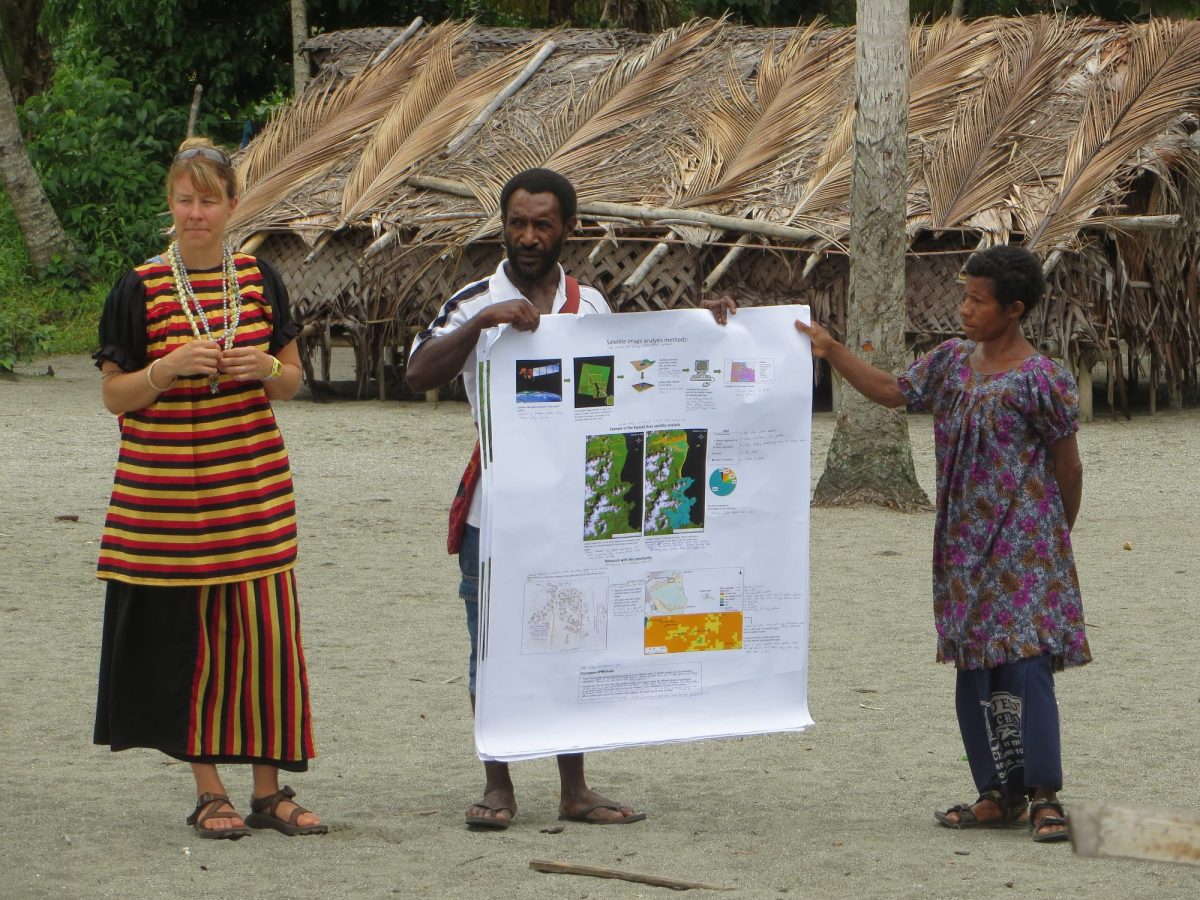
Hoover shared and validated her results with the Kamiali community and ran a workshop during a second visit to Papua New Guinea. “I wanted the community to benefit from the research conducted in their village,” says Hoover. “The workshop looked at the drivers of climate and social change that could influence land management decisions. We did a variety of scenario exercises and participatory mapping to spatially identify how resource use and location would change respective to the scenario.”
Hoover combined GIS and remote sensing technologies with qualitative methods commonly used in anthropology and cultural geography. “The community created a video via VideoVoice methodologies, a community-based research method in which the participants planned, wrote, and filmed a video on the village life, gardening (agriculture), fishing, and river and forest resources,” explains Hoover. Local knowledge is vital in order to understand the social, political, economic, and environmental impacts on land-use and ultimately land-cover. The video was not directly linked to Hoover’s dissertation, however, the project provided a unique perspective of livelihood and resource importance from the viewpoint of the land manager instead of only from the perspective of her research objectives.
Road Expansion in Vietnam
Eric Rounds came to his master’s program with an undergraduate degree in history and minors in anthropology and geography. He was interested in exploring human-environmental interactions and wanted experience in GIS and remote sensing.
Rounds contacted Leisz about working on land-use and land-cover change. “He offered me an opportunity to do fieldwork in Southeast Asia for a month,” says Rounds. “He had funding from NASA’s Land-Cover/Land-Use Change Program to conduct research in central Vietnam, and I was eager to participate.”
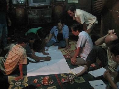
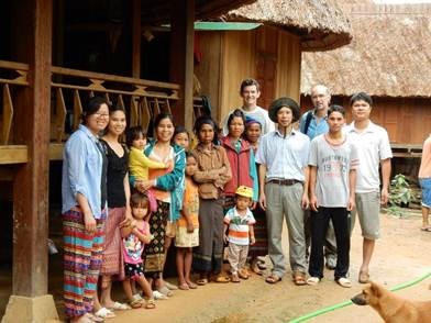
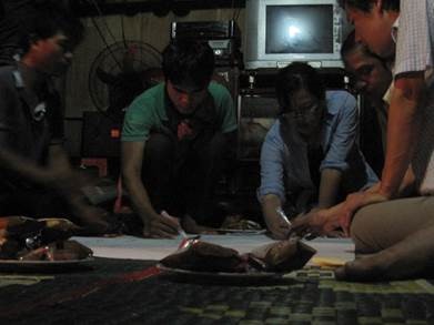
Vietnam has been working with other regional governments through the Association of Southeast Asian Nations to facilitate trade and accelerate economic development along the East-West Economic corridor, a highway that stretches from Vietnam to Myanmar. Part of this effort has focused on integrating adjacent rural agrarian communities into the broader economy. As a result, roads were built starting in 2005 to connect impoverished villages in the uplands of Quang Tri province to the Ho Chi Minh highway and National Highway 9, which are both part of the East-West Economic corridor. Rounds examined the socio-economic impact of road expansion on the communities in Quang Tri for his thesis research. He gathered data by interviewing the community, going with locals to visit the land that they cultivate, collecting GPS points for use in developing land-cover maps, and gathering data on their land use and agricultural practices. He used this information to conduct a historical land cover analysis.
Rounds used remote sensing technology to examine the location of swidden fields, road expansions, and the location of grazing areas and upland rice in relation to transportation networks over time. He then used ground truth GPS data to guide the creation of land-cover maps and validate the location of the different land covers and field placements of crops such as maize (corn), acacia trees, and cassava. Many geographers ‘ground truth’ when using remote sensing technology by collecting GPS points at certain features on the landscape, all the while relying on community members to help identify other important information that an image alone cannot provide. This information is used to supervise the classification of land-cover and assess the accuracy of outputs.
“We found that the new roads increased connectivity and mobility to other areas,” explains Rounds. “These changes fostered significant changes to land use, land cover, and livelihoods.” Local road expansions increased connectivity and the community started to integrate into the regional market economy. The village transitioned from subsistence agriculture to growing crops for profit. Poverty within the village decreased with more income and access to more livelihood options.
Applying Geographic Methods to a Career
In addition to their coursework and research, Hoover and Rounds were graduate teaching assistants for geography courses in the Department of Anthropology and were involved with the CSU Geospatial Centroid, a spatial technology resource center in the Morgan Library, which provided valuable experience for students and assistance to the campus and the community.
“In addition to my thesis research, two experiences helped me in my career search,” says Rounds. “I joined the Geospatial Centroid while at CSU, where I was able to get hands-on experience on a variety of projects and network with people in the geography community.”
“The second experience was with NASA DEVELOP. The projects that I worked on provided me with more remote sensing experience with applications that I had never considered or focused on.”
Rounds learned about a remote sensing specialist and trainer position at Redcastle Resources through a Geospatial Centroid email. Redcastle Resources is a contracting company for the USDA Forest Service at the Geospatial Technology and Applications Center. “I manage remote sensing and GIS projects aimed at enhancing land management decisions with pertinent spatial data and analyses. I also provide on-site and webinar-based trainings for federal employees that cover a wide range of topics such as lidar, change detection, and land-cover mapping,” says Rounds. “I feel extremely lucky to be able to work on interesting projects that influence land management decisions, and to be able to teach others about geographic methods and technology.”
Hoover also benefited from her work with the Geospatial Centroid. While completing her M.S. in watershed science at CSU, Hoover helped develop the Centroid with assistant director Sophia Lynn. “I was very active in the Centroid and helped facilitate GIS Day for four years,” says Hoover. “As a Ph.D. candidate, I knew that I didn’t want to go into academia and one of my connections on campus told me about a job at the National Park Service (NPS).”
The NPS Spatial Ecology job that Hoover accepted is with the Water Resources Division in the Natural Resource Stewardship and Science Directorate. “The job was in the realm of what I was searching for – mapping, natural resources, and land management. I create maps of the ocean and lake bottoms, and benthic habitats within the parks,” explains Hoover. “The NPS is faced with the challenges of climate change, increasing population sizes, and overuse. It is really rewarding being able to help with these issues.”
The geography program continues to serve students across majors and has recently expanded. As of June 2018, an undergraduate geography major and two minors are available. To learn more about the geography program, visit the department’s website.
Hoover has a Ph.D. from the Graduate Degree Program in Ecology, an inter-departmental and nationally top-ranked program. Rounds has a master’s degree in Anthropology.

